


28 big American cities are sinking
Subsidence threatens 34 million Americans–from Denver to DC. The post 28 big American cities are sinking appeared first on Popular Science.
It’s not unknown that some major urban areas in the United States are sinking. And the problem could be even more widespread. A new analysis of the 28 most populated cities in the country found that all of them are sinking by roughly two to 10 millimeters (about 0.07 to 0.39 inches) per year. The major cause? Groundwater extraction as the demand for freshwater grows. The findings are detailed in a study published May 8 in the journal Nature Cities.
Small measurements, big impacts
While land sinking less than an inch per year might not seem like much on paper, small shifts in land can have big effects. Land shifts downward can impact the structural integrity of buildings, roads, bridges, and dams. A 2024 study found that regions of the Atlantic coast to be sinking by as much as five millimeters per year.
This new study used satellite-based radar measurements to create high-res maps of subsidence–or sinking land– in these areas. They looked at the subsidence for the 28 most populated cities in the US–including New York, Dallas, and Seattle–which are home to 34 million people or roughly 12 percent of the US population.
“What makes this work especially powerful is the use of satellite radar (InSAR) to map subsidence in incredible detail,” study co-author and Virginia Tech geodesist/geophysicist Manoochehr Shirzaei tells Popular Science. “Think of it like getting a CAT scan of the Earth’s surface—except from space. This technology helps city planners and engineers pinpoint exactly where the ground is moving, which is essential for proactive maintenance, zoning, and flood risk planning.”
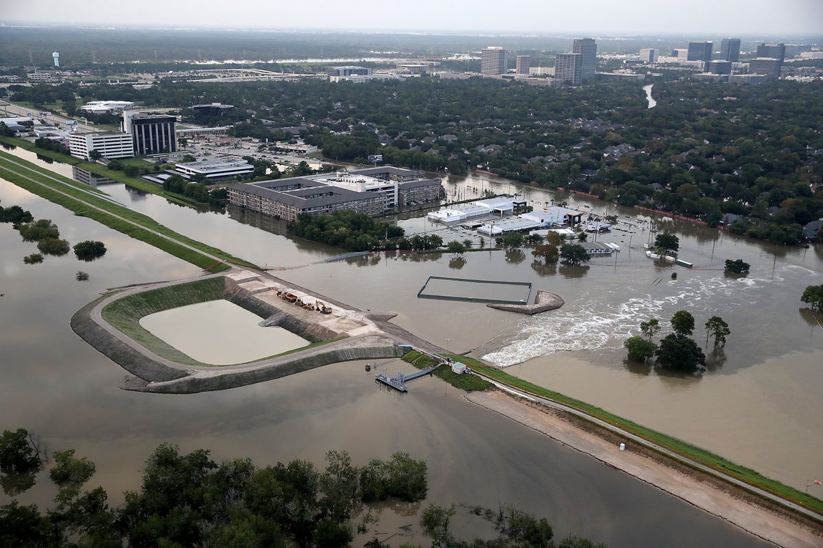
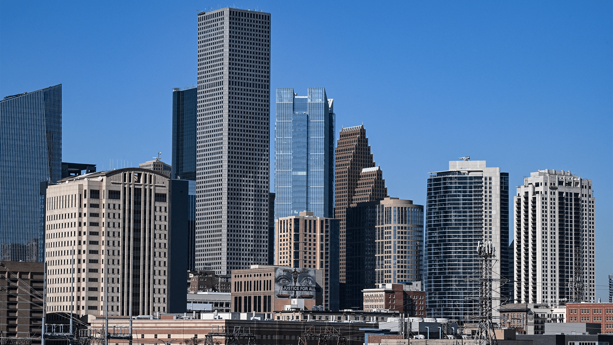
In all of the cities studied, at least 20 percent of the urban area is sinking. In 25 out of the 28, at least 65 percent is sinking. New York, Chicago, Seattle, Denver, Columbus, Dallas, Forth Worth, and Houston are sinking at roughly two millimeters per year. Additionally, several cities in Texas showed some of the highest measured rates of subsidence at about 5 millimeters per year. Certain parts of Houston are seeing as much as 10 millimeters per year, according to the study.
[ Related: NYC is sinking and climate change is only making it worse. ]
“A lot of small changes will build up over time, magnifying weak spots within urban systems and heighten flood risks,” Leonard Ohenhen, the study’s lead author and a postdoctoral research scientist at Lamont-Doherty Earth Observatory at Columbia University, said in a statement.
This evidence from Houston shows some differences in sinking rates between localized zones and areas right next door. This shows one of the more harmful and somewhat invisible effects of subsidence. With something like flood hazards, the risks are visible only when the land sinks below a specific threshold. However, inconsistent land motion–like what researchers observed in Houston–can crack and destabilize buildings, foundations, and infrastructure.
Signs of sinking
When the team assessed how infrastructure risks increase when subsidence rates vary, they found that New York, Las Vegas, and Washington, DC. also had high rates of variance. The slow nature also means that its infrastructure quality can be quietly compromised over time, according to Shirzaei.
“Several telltale signs of land subsidence are visible to the naked eye and may indicate early stages of ground sinking or differential settlement,” he says. “In urban areas, these signs often appear gradually but can become serious if left unaddressed, especially in cities built on soft soils or where groundwater is heavily extracted.”
Shirzaei says that some of these telltale signs include:
- Cracks in buildings, especially around doors, windows, and foundations, uneven or sloping floors inside homes or buildings.
- Misaligned doors and windows that no longer close properly.
- Warped roads or buckling pavements, often misattributed to poor construction.
- Tilting utility poles or fences, which can be an indicator of shifting ground.
- Increased local flooding, especially during normal rain events, as land sinks and alters drainage patterns.
The roots of the problem–and solutions
Continued urban sprawl and population growth only increases the demand for freshwater. If water is taken out of an underground aquifer faster than it can be replenished, the aquifer itself can crumble and compact in the ground.
“One of the key takeaways from our study is that land subsidence is not just a coastal problem or something happening far away—it’s occurring in many of America’s cities and affecting millions of people,” Shirzai says. “More than 34 million urban residents live on sinking ground, and over 29,000 buildings are in high-risk zones. Subsidence often occurs slowly—millimeters per year—but its effects accumulate and can silently undermine infrastructure like roads, bridges, and homes.”
The compounding effects of shifts in weather patterns with continued urban population and socioeconomic growth are also possibly accelerating the rate of land sink. Previously stable urban areas could be transformed into vulnerable zones for flooding, infrastructure failure, and long-term land degradation.
Based on the data from this study, the team suggests that cities integrate land subsidence monitoring into urban planning policies to keep risks from getting worse. They also recommend targeted strategies including managing groundwater to reduce excessive withdrawals and long-term monitoring to facilitate early action.
“There’s a hopeful message: subsidence is a solvable problem,” says Shirzaei. “Much of it is caused by human actions, especially overuse of groundwater. With better monitoring, smarter urban development, and policies that address water use and infrastructure resilience, we can slow or even stop the sinking—and protect our cities for future generations.”
The post 28 big American cities are sinking appeared first on Popular Science.