


7 Google Maps tips to use with Android Auto and CarPlay
From customizing your car avatar to reporting police. The post 7 Google Maps tips to use with Android Auto and CarPlay appeared first on Popular Science.
Google Maps, whether you’re using it on Android or iOS, is an app packed with features—from guides to what to see in your local area to the ability to share your location with friends and family in real time. It’s one of the most comprehensive apps out there, and Google is consistently adding new features.
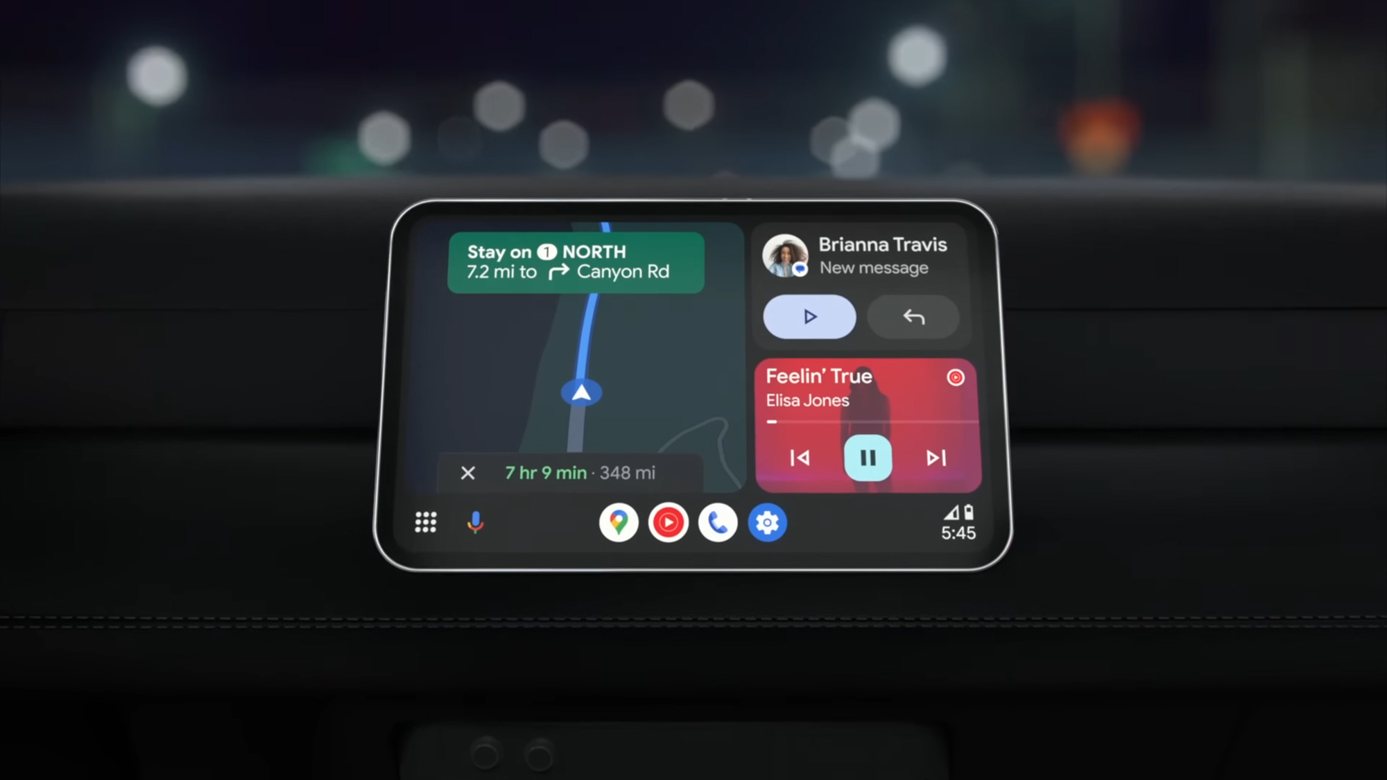
Google Maps is also fully compatible with Android Auto and Apple CarPlay, so if you have one or both of those services installed on your vehicle’s dashboard, you’ll see the mapping app pop up when your Android phone or iPhone is connected. There are several useful features you can tap into in Google Maps on that second screen.
Change the look of your vehicle
You don’t have to settle for the standard blue arrow that represents your vehicle on the map: Look up directions for your trip on your phone, and on the preview card (showing the estimated travel time), tap the icon showing three sliders on the right. Next, choose Driving avatar to pick a new icon and a new color for the map.
Find somewhere to stop on the way

If you want to stop for gas, groceries, or something else during your journey, you’re in luck: You can do this without losing the step-by-step navigation that’s already showing on screen. On the travel card on Android Auto (showing the estimated travel time), tap the magnifying glass icon, then run a search for the type of place you’re looking for.
You’ll see some examples, like coffee shops and gas stations, which you can select with a tap. Google Maps shows you the best matches along your current route, together with how much time the detour will take—tap on any of the options to add it to your route. The step-by-step instructions are then updated to include the extra stop you’ve just added.
It’s a little different if you’re using Google Maps through Apple CarPlay: You tap on the travel card, then tap Add stop at the top, which brings up a list of suggestions. Both Android Auto and Apple CarPlay let you type out or speak out a specific type of location you want to stop at. As always, be careful doing any of this while you’re moving.
Switch up the perspective of the map

On Android Auto, you’ll see a compass icon on the right. Tap this switch between three map views: a 3D perspective view, an overhead north up view, and a journey overview. On Apple CarPlay, you only get the 3D and north up views;you can get at them by tapping the travel card showing your journey time, then the gear icon.
Help out other road users

Google Maps comes with a built-in feature for alerting other users about what’s happening on the road. If you’re using Google Maps in Android Auto or Apple CarPlay, you can find it by tapping on the yellow hazard icon (the triangle) on the left or right of the interface. A new box pops up letting you report a range of incidents at your location.
The options here vary slightly depending on where you are in the world, but they’ll typically include Crash, Congestion, and Lane closure. If enough Google Maps users make the same report in the same place, then Google will update its traffic databases accordingly—so everyone sees the extra information you’ve added.
Choose what’s shown on screen

You’ve got options when it comes to what’s shown on the map. On your vehicle display, tap the gear icon (Android Auto), or the travel card and then the gear icon (Apple CarPlay), and you get options for showing current traffic conditions and a satellite view. On Android Auto, there’s also a 3D buildings view you can use instead of the satellite map.
Share your journey with other people

Whether you’re heading to a work conference or a family get-together, the people you’re meeting will appreciate knowing when you’ll actually arrive (and it saves you from having to keep stopping to send messages letting everyone know you’re going to be late).
At the time of writing, this is only available in Google Maps on Android Auto, though. Tap the three dots on the travel card (showing your estimated journey time), then pick Share journey. A list of contacts pops up, but you can also search through the list by typing or talking. Your chosen contact can then see where you are as your journey progresses.
Change the audio prompts you hear

You don’t necessarily want to have every step of a trip spoken out by Google Maps, especially if you’re trying to listen to a podcast, or you’re on a route you’re pretty familiar with. Tap the speaker icon on the dashboard to mute or unmute audio instructions; on Android Auto, you can also pick Alerts only (so just relevant road incidents).
The post 7 Google Maps tips to use with Android Auto and CarPlay appeared first on Popular Science.