


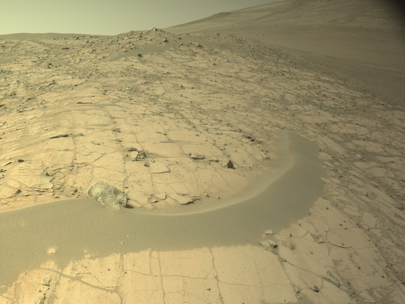


Sols 4561-4562: Prepping to Drill at Altadena
Written by Conor Hayes, Graduate Student at York University Earth planning date: Wednesday, June 4, 2025 We are continuing to look for a suitable location to collect a drilled sample in this area. As you may recall from Monday’s plan, we performed a short “bump” of just under 4 meters (about 13 feet) hoping to […]
4 min read
Sols 4561-4562: Prepping to Drill at Altadena
Written by Conor Hayes, Graduate Student at York University
Earth planning date: Wednesday, June 4, 2025
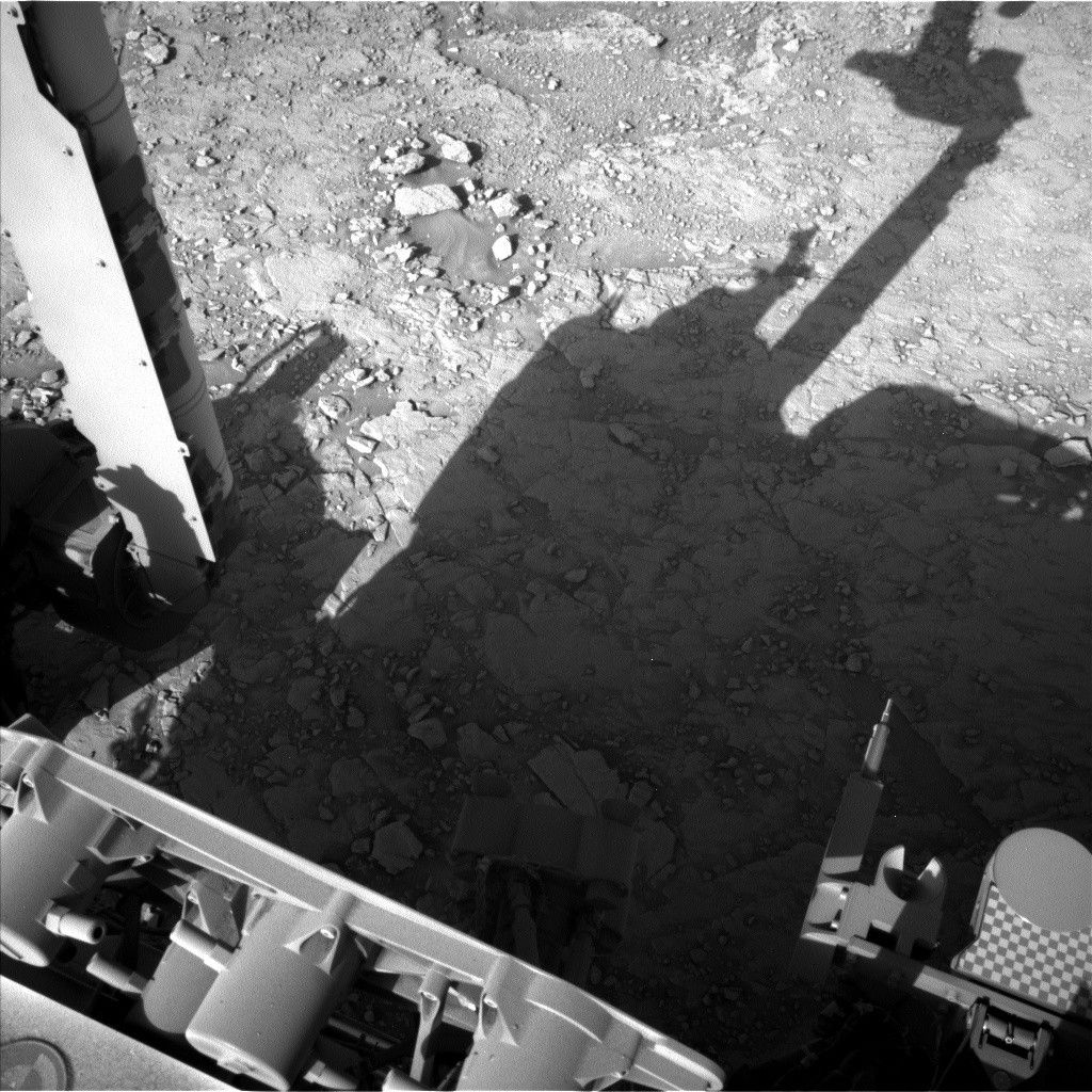
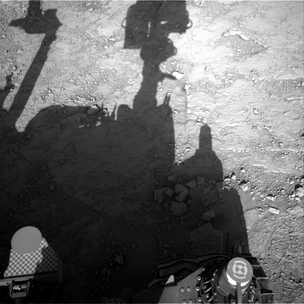
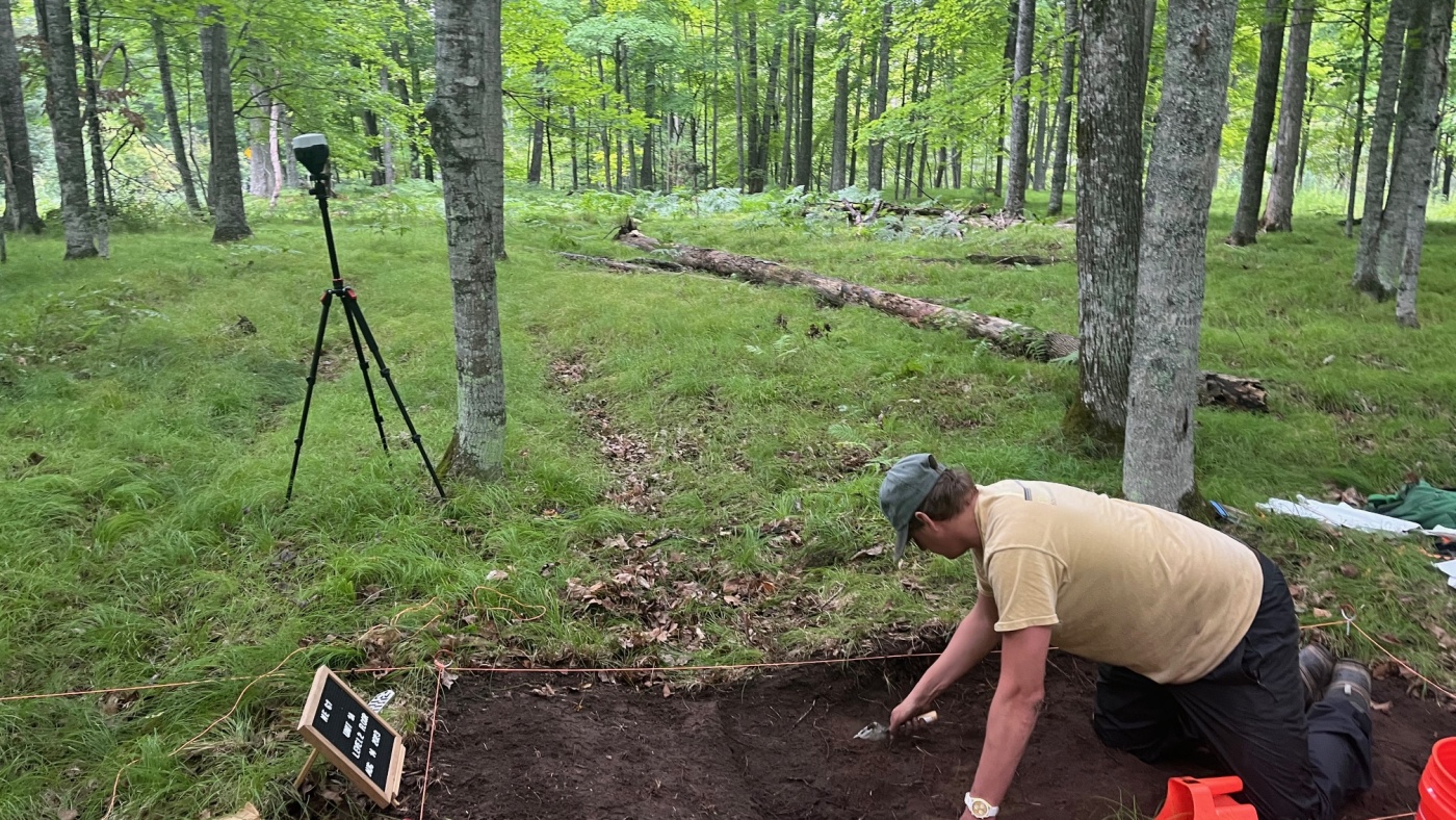
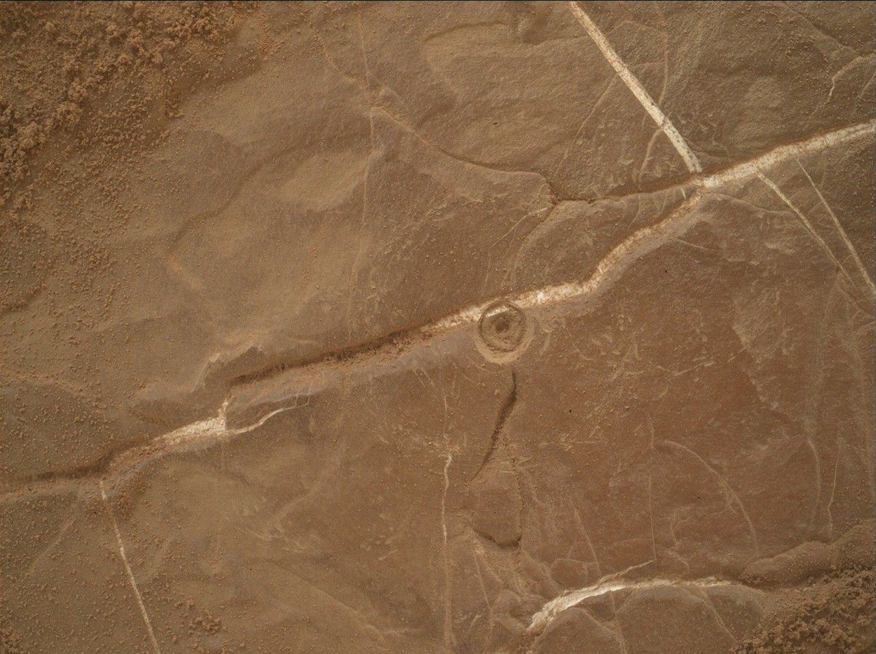
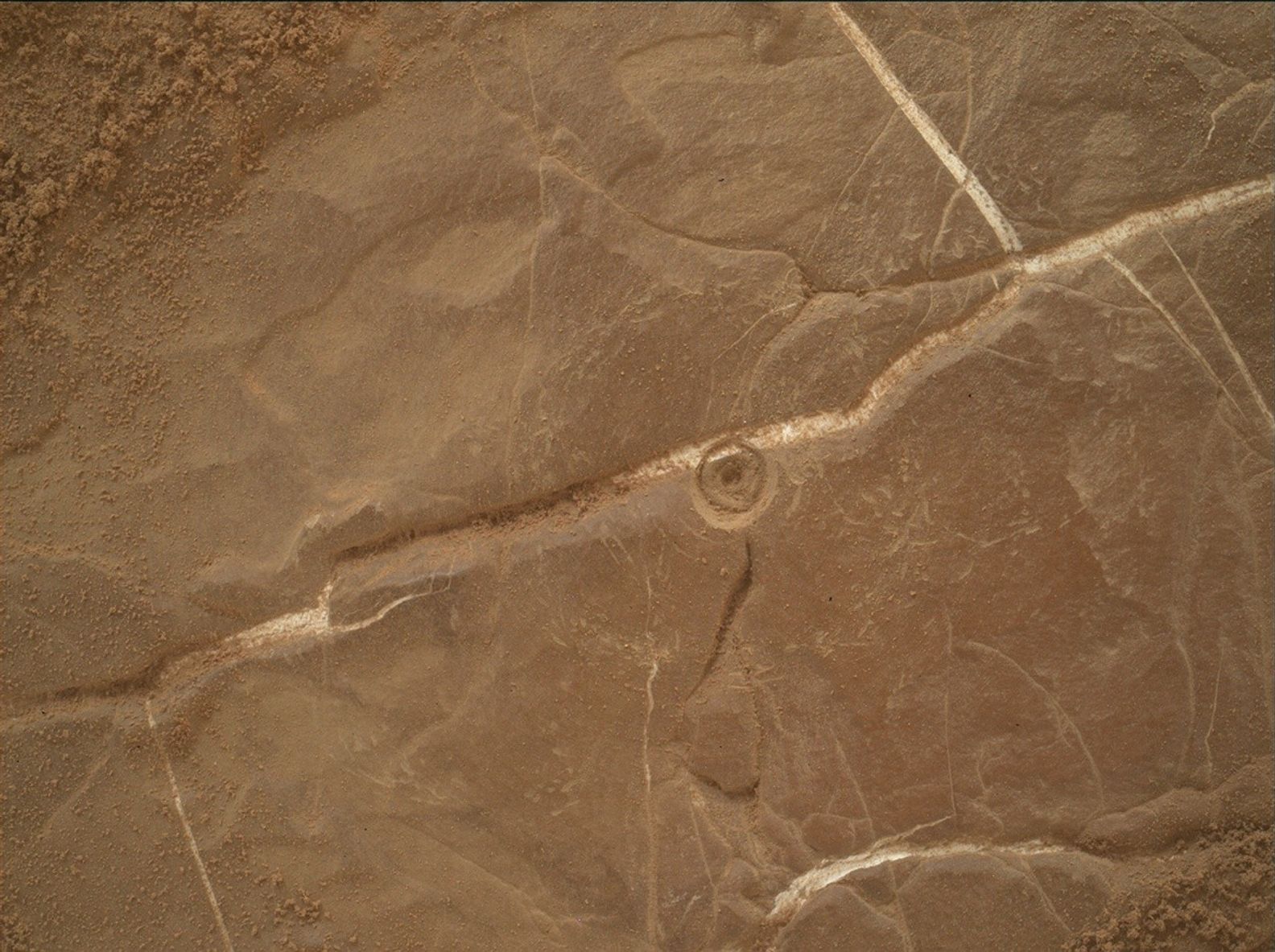
We are continuing to look for a suitable location to collect a drilled sample in this area. As you may recall from Monday’s plan, we performed a short “bump” of just under 4 meters (about 13 feet) hoping to find a drill target today after Monday’s analysis determined that there were no good targets in our previous workspace. Happily, today’s workspace was much more cooperative, and we were able to select the target “Altadena” as our next potential drill location. Altadena is a name that we’ve been saving for a special target, as its namesake here on Earth is a neighborhood next to JPL that was devastated by the Eaton Fire earlier this year. We’re about to enter our next mapping quadrangle, which will come with a new set of target names, so the team decided that using Altadena as the name for this drill site was an obvious choice.
The big activity in this plan is the next step in the drilling process. This activity is the “preload test,” which determines if the forces on the drill will be good while drilling, and the drill target won’t unexpectedly move or fracture. If we pass the preload test and find that the rock has the chemistry we’re looking for, we’ll be able to proceed with Altadena as our next drill site. If we don’t, we’ll have to decide whether to bump again or resume driving deeper into this potentially boxwork-bearing region.
Of course, the preload test isn’t the only thing we’re doing today. Coming in, it was looking like our time for other activities would be pretty tight due to power constraints imposed by preparations for drilling and keeping the rover warm during the cold Martian winter. However, we’ve recently implemented some new power-optimizing capabilities, which led to us having much more power today than we expected. This meant that we were able to add a whole additional hour of science time in addition to the hour that we already had scheduled.
Unsurprisingly, Altadena gets a lot of love in this plan to characterize it before we drill. This includes a ChemCam LIBS activity and a Mastcam observation, as well as some overnight observations by APXS and some MAHLI images. In addition, Mastcam will be observing some exposed stratigraphy at “Dana Point,” a light-toned vein at “Mission Trails” that will also be a ChemCam LIBS target, a few more nearby troughs, and a couple of sandy patches at “Camp Williams” to observe wind-driven sediment transport. Along with the two LIBS, ChemCam will be using its RMI camera to add to the pile of images we have of the Mishe Mokwa butte and the yardang unit off in the distance.
As the lead for the Atmosphere and Environment (ENV) group today, it looked like I was going to have a pretty light workload due to the power constraints preventing any ENV activities other than our usual REMS, RAD, and DAN observations. With the extra hour of science time, I was able to add a handful of new activities, including three Navcam cloud movies, a Navcam line-of-sight observation of dust within Gale Crater, and a Navcam survey to look for any dust devils that may be swirling around the rover. A pretty decent ENV science haul for a plan that started with nothing!
When we come into planning on Friday, we’ll hopefully have passed the preload test and will be able to turn Altadena into our 43rd drill hole in the coming sols, before we continue driving up the slopes of Mount Sharp.