


Searching for the Dark in the Light
Written by Eleanor Moreland, Ph.D. Student Collaborator at Rice University Perseverance has been busy exploring lower “Witch Hazel Hill,” an outcrop exposed on the edge of the Jezero crater rim. The outcrop is composed of alternating light and dark layers, and naturally, the team has been trying to understand the makeup of and relationships between […]

2 min read
Searching for the Dark in the Light
Written by Eleanor Moreland, Ph.D. Student Collaborator at Rice University
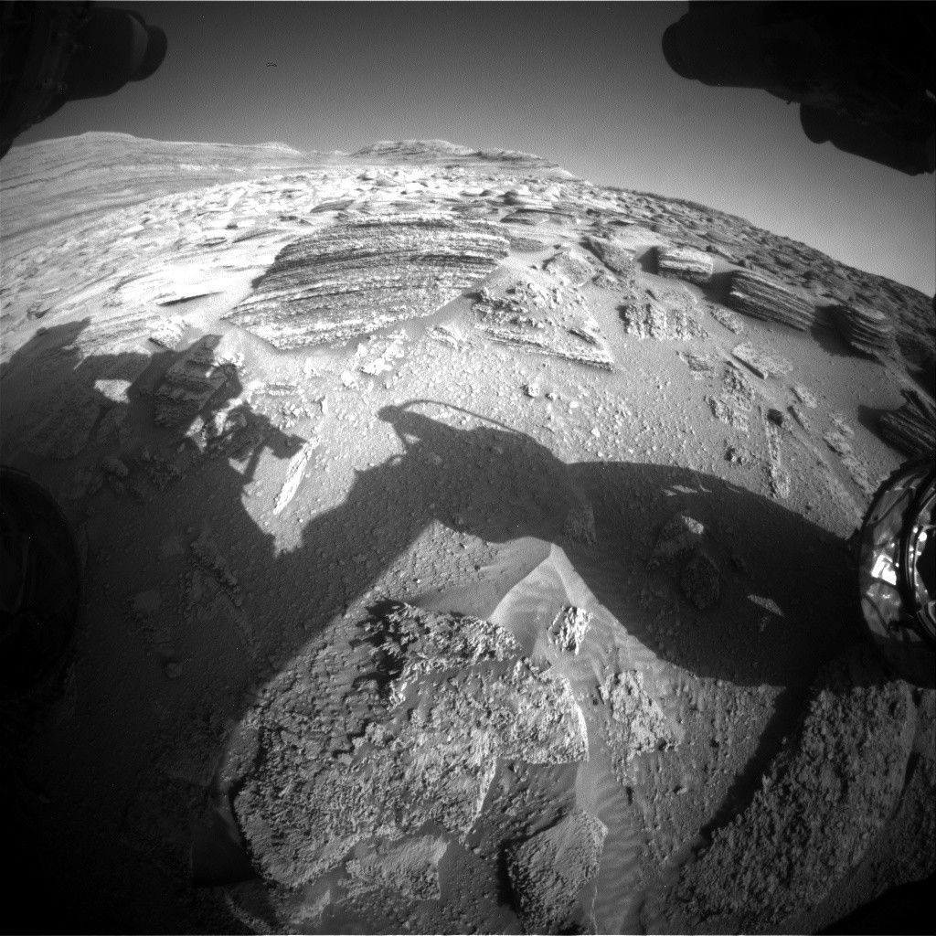
Perseverance has been busy exploring lower “Witch Hazel Hill,” an outcrop exposed on the edge of the Jezero crater rim. The outcrop is composed of alternating light and dark layers, and naturally, the team has been trying to understand the makeup of and relationships between the light and dark layers. A few weeks ago, we sampled one of the light-toned layers, which we discovered was made up of very small clasts, or fragments of rocks or minerals, at “Main River.” Since then, we have learned that the dark layers tend to be composed of larger clasts compared to the light layers, and we’ve been searching for a place to sample this coarser-grained rock type. Sometimes, these coarser-grained rocks also contain spherules, which are of great interest to the science team because they provide clues about the process that formed these layered rocks.
Perseverance first looked at a dark layer at “Puncheon Rock” with an abrasion. We then examined a dark layer at “Wreck Apple,” near “Sally’s Cove,” but we could not identify a suitable surface to abrade. So, while team members searched for other locations to study the coarse-grained units and spherules, Perseverance drove south to “Port Anson.”
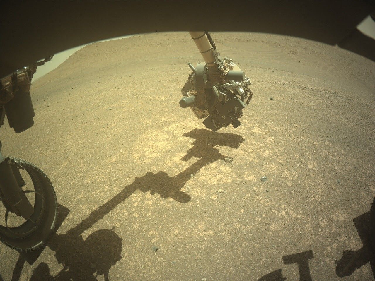
Port Anson was intriguing because, from orbit, it showed a clear contact between the light layers of Witch Hazel Hill and a distinct unit below it. And, although the rocks below the Port Anson contact do show interesting compositional differences with those of Witch Hazel Hill, they weren’t the coarse-grained rocks we were looking for. We still performed an abrasion there, at Strong Island, before driving back up north for another attempt at investigating the coarser-grained rocks.
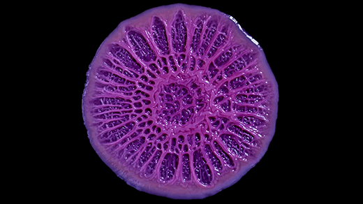
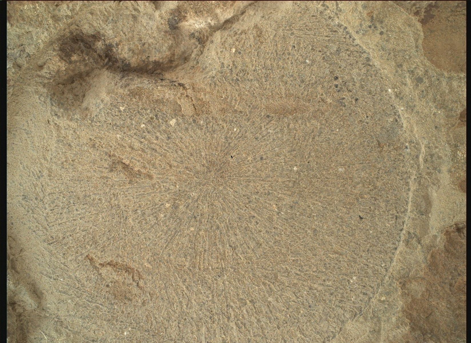
We aimed for “Pine Pond,” which neighbors “Dennis Pond,” to abrade at “Hare Bay.” With the data just coming down over the weekend, the team will be hard at work to figure out if we captured the coarse grains and spherules, and if it is representative of rocks we have seen before or not. The image below is a close-up of this most recent abrasion patch at Hare Bay — what do you think? Stay tuned to find out!