


Kachemak Bay’s Stony Waters
The OLI (Operational Land Imager) on Landsat 8 captured an image of Kachemak Bay’s turbid, cloudy waters on September 20, 2024.
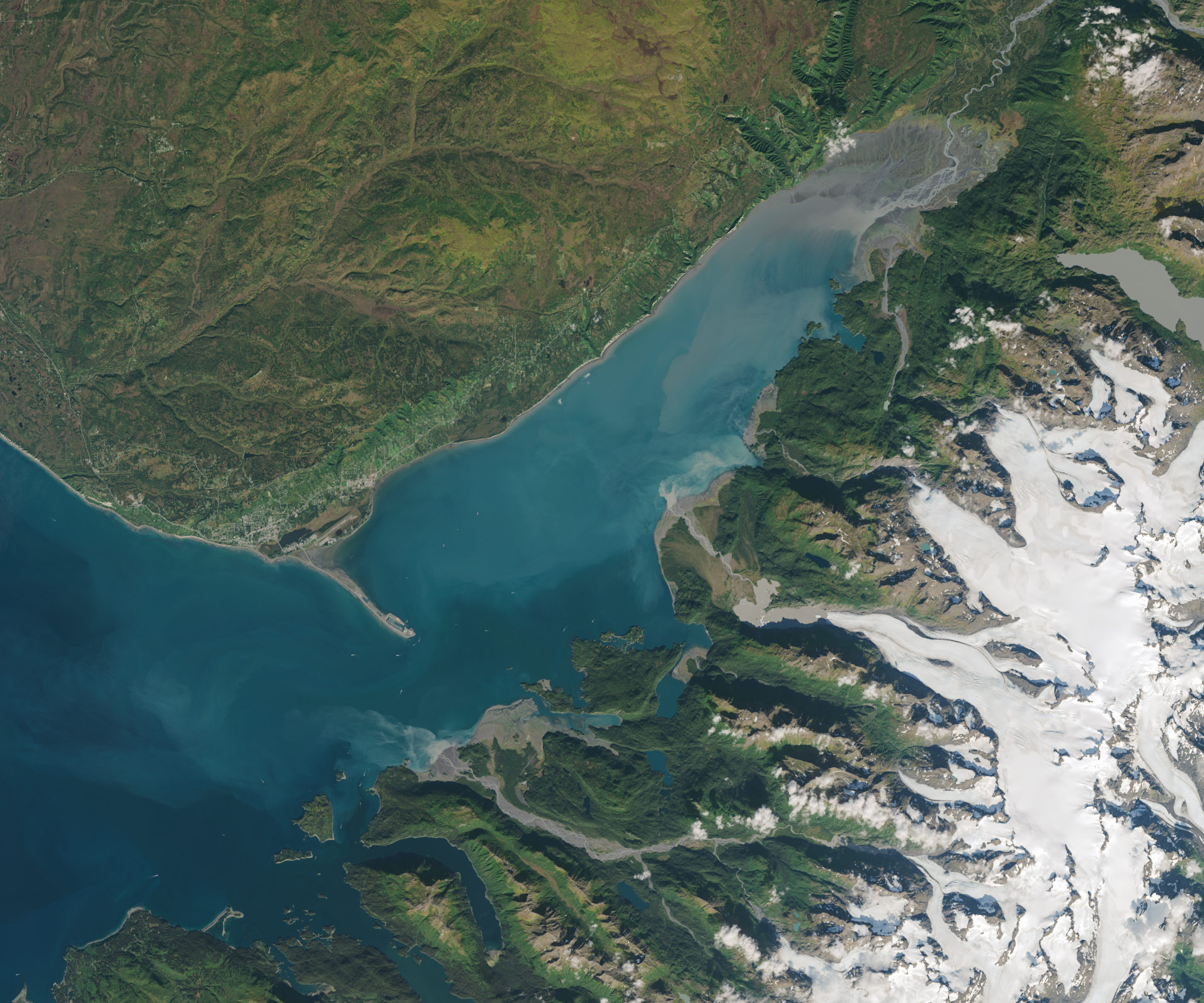
The OLI (Operational Land Imager) on Landsat 8 captured an image of Kachemak Bay’s turbid, cloudy waters on September 20, 2024.